ISO 25178 · Surface Metrology
Surface analysis,
in the browser.
Full topography analysis powered by surfalize — running entirely client-side via WebAssembly. No server. No installation. No data leaves your machine.
Interactive visualisation
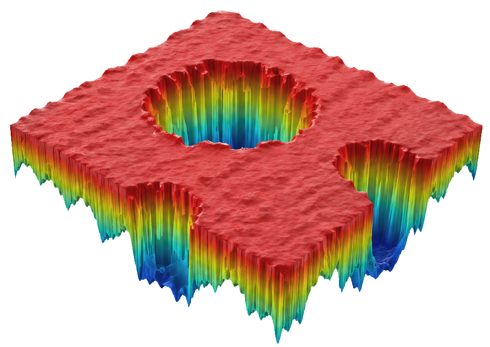
False-colour height maps, interactive 3D surface rendering, power spectral density and Abbott–Firestone curves — all rendered with Plotly.
Non-destructive work tree
Chain operators in a branching work tree, MountainsMap-style. Update the current plots as you preprocess, or spawn a new result for each step — originals are always preserved.
Full operator set
Levelling, three-point levelling, filtering, outlier removal, masking, cropping, cylinder removal, profile extraction — chainable in any order.
Every ISO 25178 areal parameter
Height, hybrid, spatial, functional, feature and volume parameters computed directly from surface topography per ISO 25178-2 and validated against MountainsMap — including the feature parameters (new). Full ISO 21920 profile (R) parameters are available on any extracted profile.
View full parameter listDrop your topography file into the browser. All processing happens locally.
Apply operators from the ribbon — update the current plots in place, or branch off a new result.
Select parameters and compute. View height maps, Abbott–Firestone and PSD plots.
Run batch analysis across multiple files and export a full parameter table as CSV.
Ready to analyse your surfaces?
No installation required. Runs entirely in your browser. Your data never leaves your machine.